Google Maps to Show the Locations of Traffic Lights
Advertisement
For drivers around the world, GPS navigation has become an indispensable tool. Google disclosed that it has begun the test of new function to show the location of traffic lights.
Many drivers rely on GPS to find the fastest or shortest route. However, a problem is, sometimes driving through longer routes encountering fewer traffic lights, which is preferred than driving through the highways which are congested, as it is ultimately faster, especially during peak hours.
In addition, poorly distributed traffic lights (which are deliberately designed to limit traffic and parking in every few blocks) is a major issue.

For example, drivers in the Upper West district of New York all know that congestion along the West District highway is very bad which turns the main road into a parking lot. Experienced drivers will maintain a speed of 20 mph and head north along Amsterdam Avenue as they will not be affected by traffic lights. On the other hand, regardless of the speed of the car, frequent stops near Broadway cannot be avoided.
Therefore, the feature which provides location information of traffic lights on popular GPS applications on mobile phones is very welcome to users.
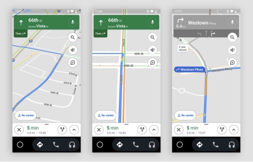
Although it has not been officially launched, the location of traffic lights will appear in some users’ Google Maps. Google seems to be testing this feature on a selected few on Android devices.
Advertisement
Google chose to carry out its tests in New York, San Francisco, Los Angeles and Chicago, which will include Stop signs. In fact, a few years ago, the local Google app in Japan had already started providing traffic light locations.
But Google is not the first company to provide the location of traffic lights. With the launch of iOS 13 a year ago, Apple Maps provided location information of traffic lights and Stop signs.
GPS is not only used for driving navigation, but also for many other purposes, such as military operations, disaster relief and emergency search and rescue missions, earthquake detection systems, cartography, photographic geotagging, robotics, mapping infectious diseases and tracking human mating habits...
GPS consists of more than 24 satellites. The GPS device must be connected to at least four satellites to ensure accurate data of location. Mountains, buildings and bad weather will affect its accuracy.
The US Department of Defense began to study GPS (Global Positioning System) in 1973. Black female mathematician, Gladys West, made great contributions. She was inducted into the Air Force Space and Missile Pioneers Hall of Fame in 2018 and is known as the mother of GPS.
Advertisement
 1
1 1
1- Previous article
- UK Government to ban Installation of Huawei’s 5G Network
- Next article
- Google AI to Help the Vision-Impaired People to Walk Independently on the Road
Advertisement
OTHER NEWS

With Mobile Payments Gaining Momentum, Can PayPal Still Take a Leading Position?
BY Scott

Study shows that well-edited hometown wiki entry will attract tourists
BY Julia

Take-Two Expects to Acquire Codemasters
BY Thomas

Following Netflix, Disney+ Raised Its Price for the First Time to $8 Per Month from March 2021
BY Harrison

How to Unlock Yoshi in Super Mario Sunshine
BY Bell

Data Report - 2020 Global Gaming Industry Acquisitions Reached $19.24 Billion
BY Clarke
RECENT NEWS
-

PUBG Mobile Esports Generated 200 Million Hours of Viewing in 2020
-

Mario Kart Tour Races to $200M revenue and 200M Downloads
-

Game Acquisitions Expand Globally in Q1 2021 with 280 Deals Worth $39 Billion Surpassing That in 2020
-

The Games Fund Launched a $50 Million Early Investment Fund to Invest in American and European Companies
-

The Next $1 Billion-level Match-3 RPG Mobile Game? Small Giant Games Releases New Zombie Theme
-

Observation | Country Multipliers Makes Monetization Easier for Developers